The Power of Weathering and Erosion – Formation of Passes
The Rich Landforms of Lantau Island
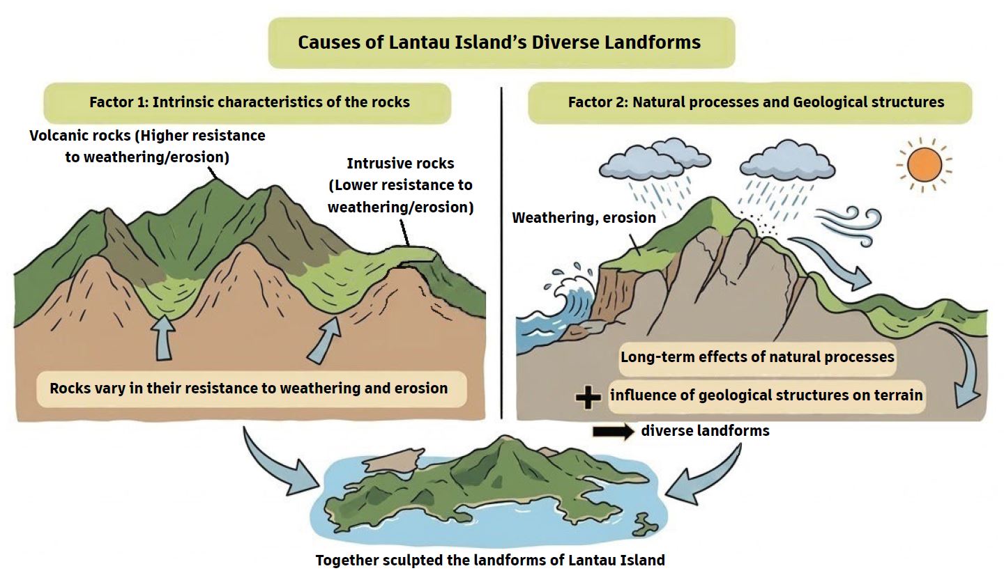
Lantau Island features a diverse range of terrestrial landforms. In addition to the high hills mentioned in the previous Geo-log, it also encompasses ridges, passes, river valleys, waterfalls, and alluvial plains. Its coastal landforms are equally rich, comprising bays, coves, beaches, sand spits and estuaries. The varied landforms of Lantau Island are jointly shaped by two primary factors. The first factor is the intrinsic characteristics of rocks, as different rocks vary in their resistance to weathering and erosion. As noted in a previous Geo-log, differences in the erosional resistance of volcanic and intrusive rocks resulted in variations in terrain elevation. The second factor involves the long-term impact of natural processes such as weathering, erosion, and sedimentation. Coupled with the influence of geological structures like faults and joints, these factors have sculpted diverse landforms.
What is Weathering?
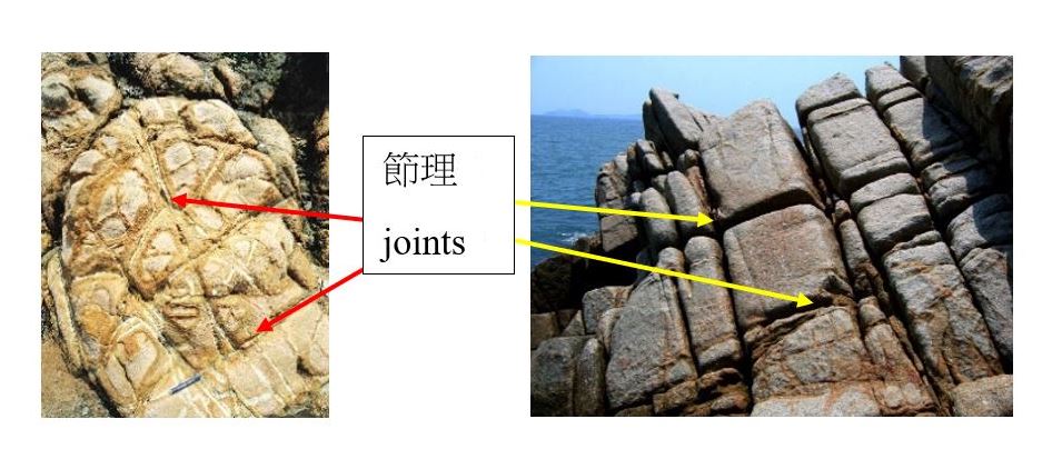
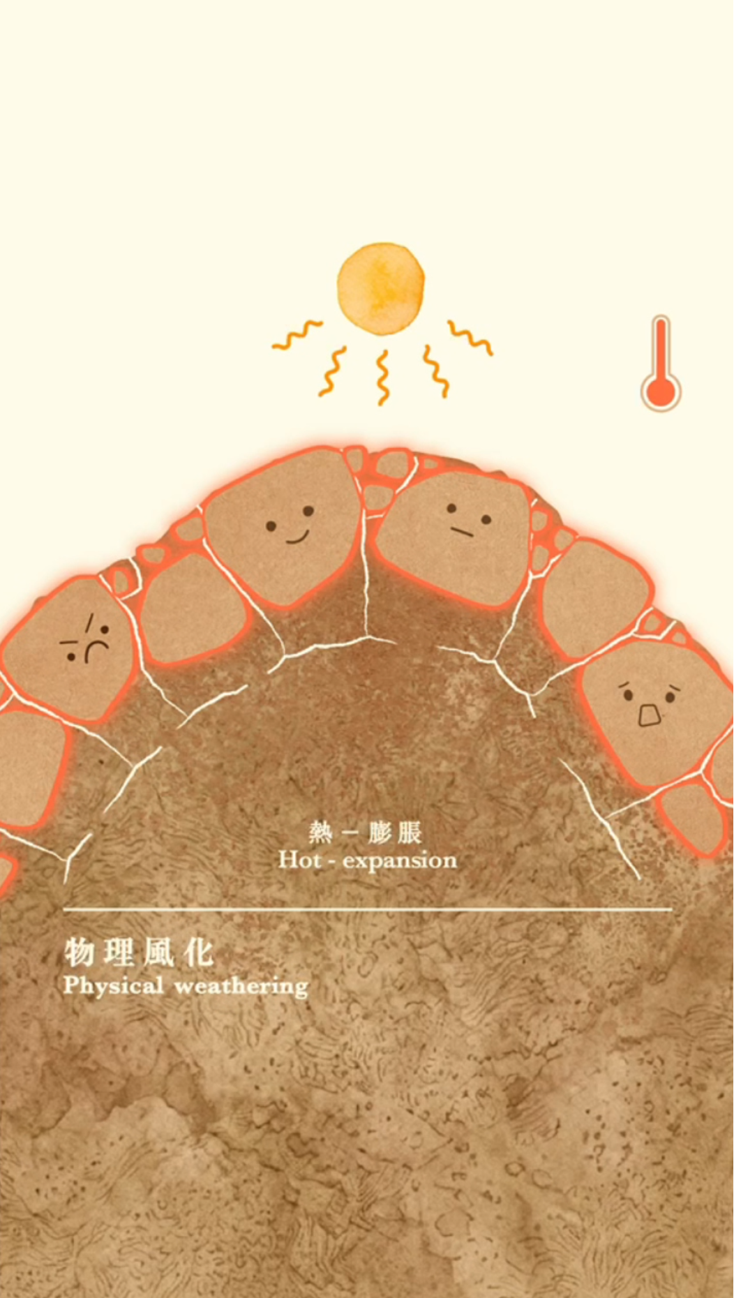
Weathering refers to the breaking down and alteration of minerals and rock masses exposed to the atmosphere. Rocks do not move during the process. They progressively soften and weaken in situ, thereby becoming more susceptible to erosion. Weathering is divided into two primary categories and one secondary category:
(a) Physical Weathering: Refers to the formation of cracks and fracturing of rocks due to mechanical disturbance (e.g. abrasion) or environmental changes (e.g. fluctuations in temperature and pressure).
(b) Chemical Weathering: Refers to the decomposition of minerals within rocks caused by water, oxygen, and weak acids, through processes such as dissolution, oxidation, hydration, and carbonation.
(c) Biological Weathering: Refers to a less pronounced weathering process caused or facilitated by the presence of plants or animals.
In tandem, these weathering processes gradually weaken rocks, creating the prerequisite conditions for erosion that sculpt the unique landforms.
What is Erosion?
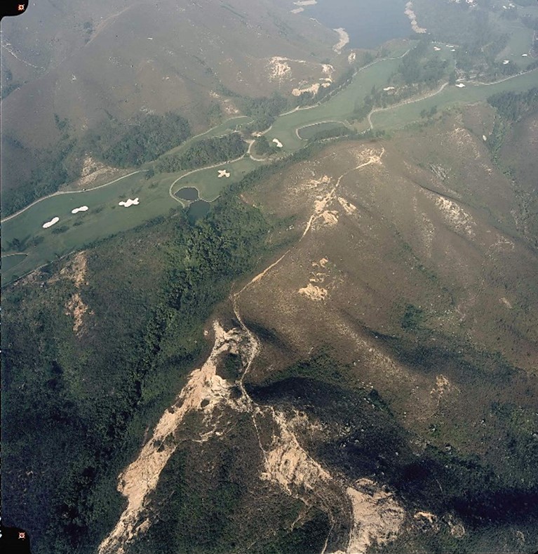
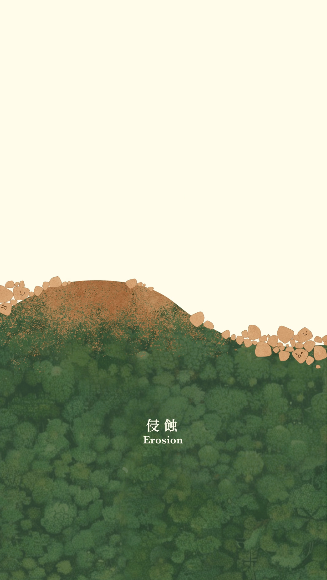
Erosion refers to the process of transporting weathered rock debris away from the site of weathering. This process can be driven solely by gravity, or facilitated by agents such as water and wind. Major erosion processes in Hong Kong include landslides triggered by gravity and water, as well as river erosion driven by flowing water. Wind erosion in arid regions and glacial erosion in cold regions have no significant impact on Hong Kong.
The Formation of Passes
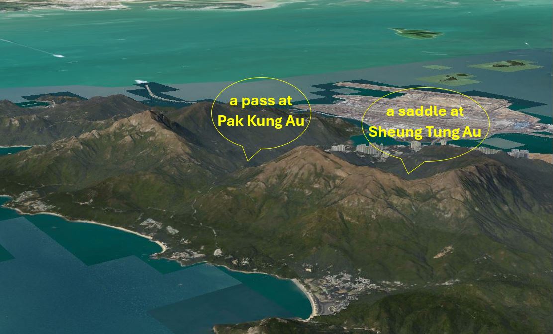
A pass refers to a low point along a ridge or the lowest depression between two mountain peaks. Its formation is closely linked to rock structure (such as the joint density or presence of fault), leading most passes to develop along fault zones. Rock masses within fault zones are relatively fractured, facilitating the infiltration of rainwater and air. Subjected to prolonged weathering and erosion, these less-resistant rocks decompose faster than those intact rocks outside fault zones, gradually forming topographic depressions. The larger, deeper depressions of this kind are called "passes", whereas the shallower, gentler ones are known as "saddles".
|
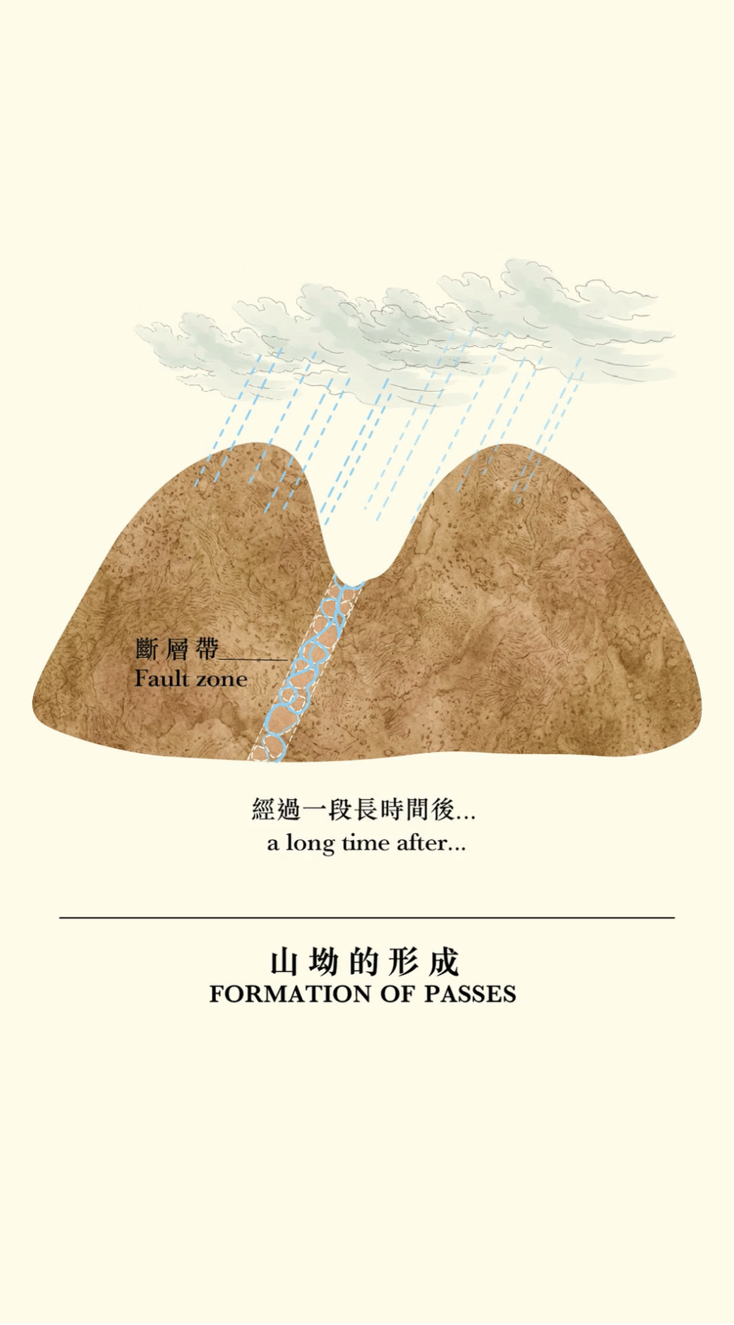
Read the Maps to identify the place names Many place names on Lantau Island contain the word "Au" (meaning a pass). Many of these places are located along major faults: |
|

Utilising Topography: Routing Through Passes

.jpg)


In the past, villagers frequently travelled across hills and ridges to reach neighbouring villages and markets for trade and social visits. Facing the undulating ridges of Lantau Island, villagers generally took the path through the low-lying passes to save time and effort.
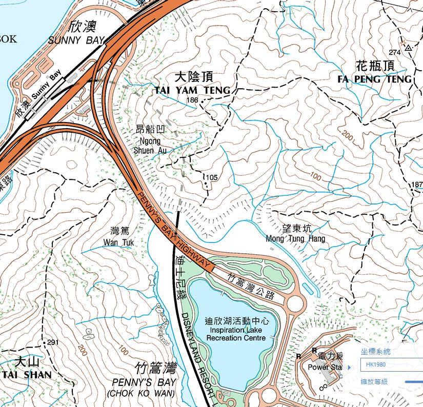
Furthermore, when planning road alignments on Lantau Island, the Government often utilises low-lying passes to traverse ridges, such as Pak Kung Au on Tung Chung Road and Ngong Shuen Au on Penny's Bay Highway. Pak Kung Au lies on a major northwest-southeast trending fault extending from Cheung Sha to Tung Chung Bay, along which Tung Chung Road was built between Lantau Peak and Sunset Peak. Ngong Shuen Au also lies on a northwest-southeast trending fault, where Penny's Bay Highway passes between Tai Shan and Tai Yam Teng to connect Sunny Bay with Penny's Bay.
|
Fault Facts |
[Acknowledgement to the Geological Survey Section of the Geotechnical Engineering Office for providing the geological and geomorphological content of Geo-logs.]